Weather forecasting has come a long way. Gone are the days of relying on gut feelings and old wives’ tales. Today’s meteorologists use cutting-edge tools to predict weather patterns with increasing accuracy.
These innovations have transformed how we understand and prepare for atmospheric changes. 1
As a veteran meteorologist with 15 years of experience at the National Weather Service, I’ve witnessed firsthand the evolution of weather prediction technology. From advanced radar systems to sophisticated computer models, these tools have revolutionized our ability to forecast. 2 Ready to explore the game-changing innovations shaping modern meteorology? 3
Key Takeaways
Weather satellites like GOES-16 take images every 5–15 minutes, allowing real-time storm tracking and improved forecasts.
Radar systems use radio waves to detect precipitation, with modern Doppler and dual-polarization radars distinguishing between rain, snow, and hail.
Weather balloons carrying radiosondes are launched twice daily from 92 U.S. locations to measure temperature, humidity, air pressure, and wind at different altitudes.
Numerical Weather Prediction models crunch massive datasets to simulate future weather, with global models forecasting up to 16 days ahead and mesoscale models zooming in on local weather.
New technologies like AI and drones are improving forecast accuracy, with UAVs gathering hyper-local atmospheric data to enhance short-term predictions.
Table of Contents
Satellite Technology for Weather Forecasting

Satellites orbit Earth, snapping pics and gathering data 24/7. These high-tech eyes in the sky feed weather APIs with crucial info on clouds, storms, and atmospheric conditions.
Weather Satellites Overview
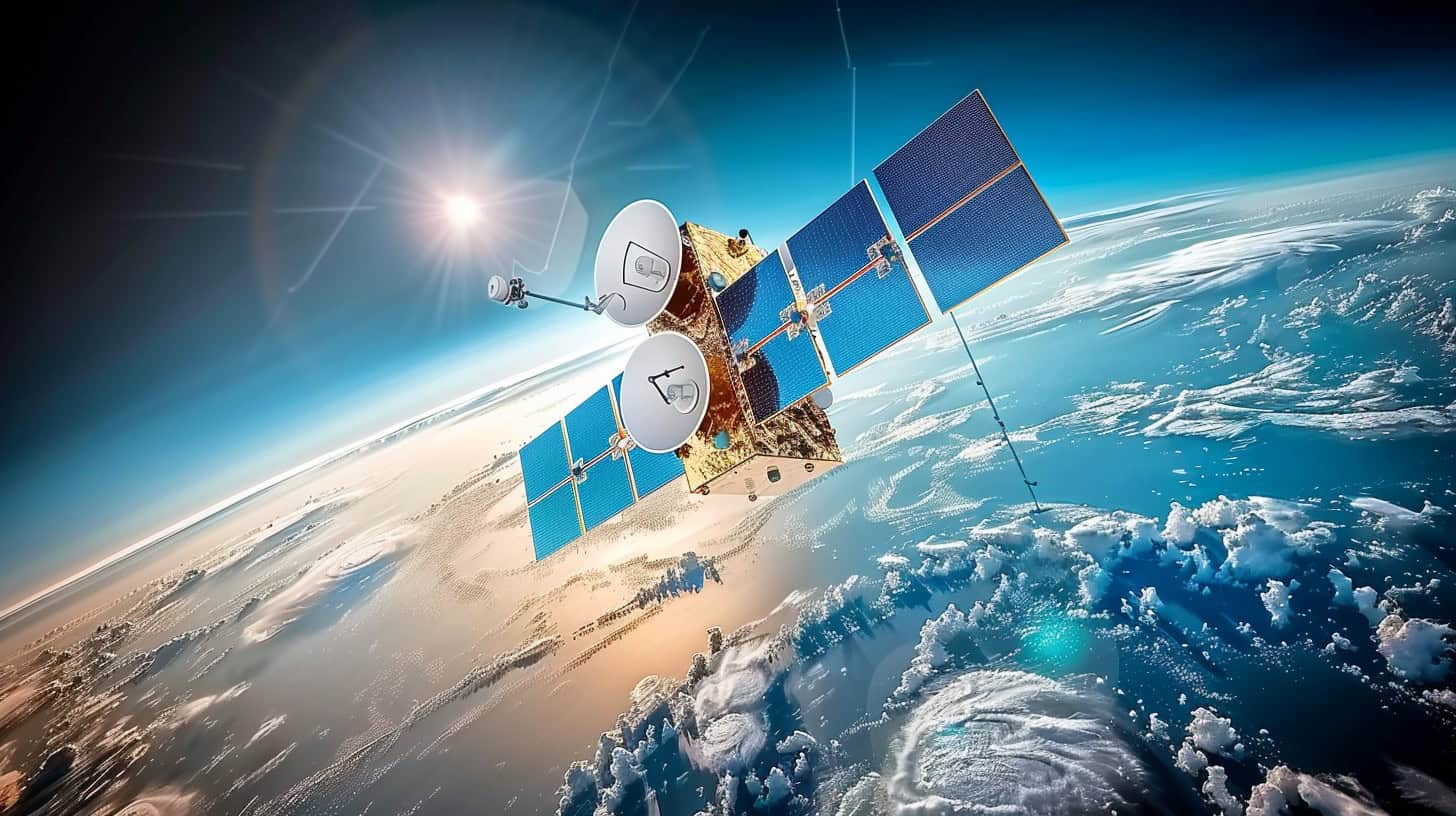
Weather satellites revolutionize meteorological forecasting. These orbiting sentinels provide continuous, global atmospheric data. Polar-orbiting satellites scan Earth twice daily, offering detailed snapshots. 1 Geostationary satellites, hovering 22,000 miles above the equator, deliver constant coverage of specific regions. 1
U.S. geostationary satellites capture images every 5–15 minutes during severe weather. GOES-16, a game-changer, offers 3x more imagery types with 4x greater resolution. It can snap severe weather photos every 30 seconds, enabling real-time storm tracking and improved forecasts.
Weather satellites are the eyes in the sky, giving us an unparalleled view of Earth’s atmospheric dynamics. 2
Different Types of Weather Satellites
Weather satellites come in various types, each serving specific purposes in meteorology. Here’s a breakdown of the main categories:
- Geostationary Satellites: Orbit Earth at 22,236 miles above the equator, matching Earth’s rotation.
- Provide continuous coverage of a fixed area
- Examples: GOES series (U.S.), Meteosat (Europe), Himawari (Japan)
- Capture images every 5–15 minutes for real-time weather monitoring
- Polar-Orbiting Satellites: Circle Earth from pole to pole at lower altitudes (540 miles).
- Cover entire globe twice daily
- Provide detailed atmospheric data for numerical weather prediction models
- Examples: NOAA-20, Suomi NPP, MetOp series
- Sun-Synchronous Satellites: Special type of polar-orbiting satellites.
- Pass over same area at same local time each day
- Ideal for long-term climate studies and change detection
- Examples: Landsat series, Sentinel-2
- Microwave Radiometers: Detect moisture and temperature through clouds.
- Measure sea surface temperatures, soil moisture, and precipitation
- Examples: GPM Core Observatory, SMOS 4
- Scatterometers: Measure wind speed and direction over oceans.
- Essential for tracking hurricanes and tropical storms
- Examples: ASCAT on MetOp satellites
- Lightning Mappers: Detect and map lightning strikes in real-time.
- Aid in severe storm prediction and tracking
- Examples: GLM on GOES-R series satellites
These satellites work together to provide a comprehensive view of Earth’s weather systems. Radar systems complement satellite data for more localized weather observations. 3
Radar Systems in Meteorology

Radar systems are the eyes of meteorologists. They send out radio waves to detect precipitation and storm patterns, giving forecasters a real-time view of weather events.
Operation of Weather Radar
Weather radar systems emit electromagnetic pulses into the atmosphere. These pulses bounce off precipitation particles, returning to the radar as echoes. The strength and timing of these echoes reveal crucial data about precipitation type, intensity, and movement. 3
Modern weather radars boast Doppler capabilities and dual polarization. Doppler radar detects the motion of particles, while dual polarization distinguishes between rain, snow, and hail.
These advancements significantly improve forecasting accuracy for winter weather, severe storms, and tornadoes. 4
Radar technology has revolutionized meteorology, providing real-time insights into atmospheric phenomena.
Varieties of Weather Radar
Radar technology has revolutionized weather forecasting since the 1970s. Modern systems offer diverse capabilities, enhancing our ability to predict and analyze atmospheric conditions. 3
- Doppler Radar: Measures precipitation intensity and wind speed/direction. It detects the Doppler shift in returned signals, revealing storm motion and potential severe weather. 4
- Dual-Polarization Radar: Sends both horizontal and vertical pulses, improving precipitation type identification. This tech distinguishes between rain, snow, and hail with greater accuracy.
- Phased Array Radar: Uses electronic beam steering for faster scans. It provides more frequent updates on rapidly changing weather conditions, crucial for severe storm warnings.
- Terminal Doppler Weather Radar: Specifically designed for airports to detect wind shear. It helps prevent aviation accidents caused by sudden wind changes during takeoff and landing.
- Mobile Radar: Truck-mounted systems for on-site severe weather research. These units allow meteorologists to gather data from areas traditional fixed radars can’t reach.
- Multi-Parameter Radar: Combines various measurement techniques for comprehensive analysis. It integrates data on precipitation size, shape, and distribution for enhanced forecasting accuracy.
Weather Balloons and Radiosondes Role

Weather balloons carry radiosondes high into the atmosphere. These devices collect crucial data on temperature, humidity, and wind speeds at different altitudes.
Functions and Measurements of Radiosondes
Radiosondes are essential tools in meteorology. These small, lightweight devices measure crucial atmospheric data. They record temperature, humidity, air pressure, wind speed, and direction.
Launched twice daily from 92 U.S. locations, radiosondes ascend on hydrogen or helium-filled balloons. 4
These high-flying instruments provide vital input for weather prediction models. As they rise through the atmosphere, radiosondes transmit real-time data to ground stations. This information helps meteorologists understand current conditions and forecast future weather patterns.
The data collected by radiosondes forms the backbone of many weather reports and severe thunderstorm warnings. 5
Numerical Weather Prediction (NWP) Models

NWP models crunch massive data sets to simulate future weather conditions. These digital crystal balls help meteorologists make more accurate forecasts… Want to know how they work? Keep reading!
Importance and Types of NWP Models
Numerical Weather Prediction (NWP) models revolutionize forecasting accuracy. These digital powerhouses crunch vast data sets to simulate atmospheric behavior. 6
- Global models: Cover the entire planet
- Examples: ECMWF, GFS
- Resolution: 10-50 km grid spacing
- Forecast range: Up to 16 days
- Regional models: Focus on specific areas
- Examples: NAM, UKMET
- Resolution: 4-12 km grid spacing
- Forecast range: 2-3 days
- Mesoscale models: Zoom in on local weather
- Examples: HRRR, WRF
- Resolution: 1-4 km grid spacing
- Forecast range: 12-36 hours
- Ensemble models: Run multiple simulations
- Provide probabilistic forecasts
- Account for uncertainty in initial conditions
- Improve reliability of long-range predictions 7
- Coupled models: Integrate atmosphere-ocean interactions
- Enhance seasonal and climate forecasts
- Capture complex Earth system dynamics
- Examples: CMIP6, CESM
- Physics-based algorithms: Apply fundamental laws
- Solve equations for fluid dynamics
- Model thermodynamics and radiation
- Simulate cloud formation and precipitation
- Data assimilation techniques: Blend observations with model output
- Improve initial conditions for forecasts
- Incorporate satellite, radar, and surface data
- Enhance forecast accuracy and lead time
Future Technologies in Weather Prediction

The weather forecasting game is changing fast. New tech like AI and drones are shaking things up – and making predictions more accurate than ever.
Integration of AI and Machine Learning
AI and machine learning are revolutionizing weather forecasting. These technologies process vast amounts of meteorological data at lightning speed, enhancing forecast accuracy and efficiency. 8 Weather APIs now leverage AI algorithms to analyze satellite imagery, radar data, and ground observations in real-time. Machine learning models identify complex patterns in atmospheric conditions, improving predictions for severe weather events and long-term climate trends.
Meteorologists use AI-powered tools to sift through terabytes of data from global forecast systems and weather stations. These smart systems automate routine tasks, freeing up experts to focus on critical analysis.
AI helps detect subtle changes in wind patterns, air pressure, and humidity that might signal developing storms or heat waves. 9 This integration of cutting-edge tech with human expertise is pushing the boundaries of weather science, promising more precise and timely forecasts for everything from daily temperatures to hurricane paths.
Use of Unmanned Aerial Vehicles (UAVs)
UAVs are revolutionizing weather forecasting. These drones bridge the gap in local short-term weather info, improving accuracy significantly. Small-sized UAVs can gather hyper-local atmospheric data, enhancing nowcasting and forecasting systems for road users.
This tech advancement has huge societal-economic value – U.S. state and local agencies spend over $2.3 billion yearly on snow and ice control ops. 10
Drone-based mobile automatic weather stations are ready for prime time. They collect real-time data on air pressure, humidity, and wind patterns at various altitudes. This info feeds into numerical weather prediction models, boosting forecast precision.
UAVs excel in monitoring hard-to-reach areas, providing crucial insights for marine weather and emergency alert systems. 11
People Also Ask
What are supercomputers in weather forecasting?
Supercomputers crunch massive data for weather models. They process info from satellites, weather buoys, and stations. This boosts forecast accuracy.
How does satellite meteorology help predict weather?
Satellites track global climate patterns. They monitor clouds, precipitation, and energy balance. This data improves short-term and long-range forecasts.
What role does the Internet of Things play in weather prediction?
IoT devices gather real-time weather data. They measure temperature, humidity, and pressure. This network enhances local forecast precision.
How does AI contribute to meteorological science?
AI analyzes weather patterns quickly. It spots trends humans might miss. This tech improves forecast accuracy and speed.
What is ensemble forecasting in meteorology?
Ensemble forecasting runs multiple weather models. It compares outcomes for better predictions. This method helps gauge forecast uncertainty.
How might quantum computing change weather prediction?
Quantum computers could revolutionize weather modeling. They’d process complex data faster than current systems. This might lead to more accurate long-term forecasts.
References
- ^ https://www.weather.gov/about/satellites
- ^ https://www.sciencedirect.com/topics/engineering/weather-satellites
- ^ https://www.weather.gov/mqt/fitz_remote
- ^ https://www.noaa.gov/stories/6-tools-our-meteorologists-use-to-forecast-weather (2017-08-14)
- ^ https://www.noaa.gov/jetstream/upperair/radiosondes (2024-06-13)
- ^ https://journals.ametsoc.org/view/journals/bams/103/8/BAMS-D-20-0326.1.xml
- ^ https://www.ncei.noaa.gov/products/weather-climate-models/numerical-weather-prediction
- ^ https://www.weathercompany.com/blog/ai-in-weather-forecasting-prediction-and-communication/ (2023-07-24)
- ^ https://www.techtarget.com/searchenterpriseai/feature/How-AI-in-weather-prediction-can-aid-human-intelligence
- ^ https://www.sciencedirect.com/science/article/pii/S0376042122000513
- ^ https://www.meteomatics.com/en/meteodrones-weather-drones/


